kevin_standlee (![[personal profile]](https://www.dreamwidth.org/img/silk/identity/user.png) kevin_standlee) wrote2016-06-29 09:12 pm
kevin_standlee) wrote2016-06-29 09:12 pm
Oregon Scenic Byways
Today we took a route I've never traveled north of Alturas. Instead of taking CA-299 west to CA-139 toward Klamath Falls, we continued north on US-395 to Lakeview. Lisa did nearly all of the driving, and therefore I took lots of photos. Click through any of these photos to see more on Flickr.
As we were leaving Alturas, I saw a deer by the side of the paralleling railroad; however, I did not get a picture of it. It wasn't the last deer I'd see today, either.

We stopped at Jerry's Restaurant in Lakeview for breakfast. This mural depicting the Nevada-California-Oregon Railway graces the back of the restaurant.
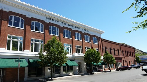
After breakfast, we walked around downtown Lakeview, which has many handsome brick buildings, a legacy of a fire that leveled the city in its early days.
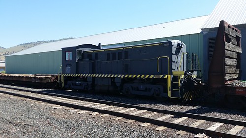
On our way out of town, we went down to the railroad tracks, where another one of the Baldwin locomotives like the one we saw yesterday languishes in the mysterious ALTX reporting marks.
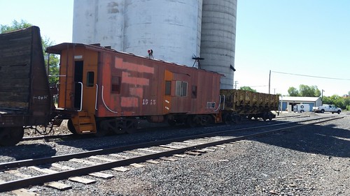
Even more anonymous is this former Southern Pacific caboose, also sporting obliterated Great Western Railway marks (GWR was a former operator of the ex-SP, ex-NCO Modoc line to Lakeview) and a dilapidated ballast car.
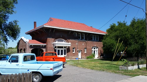
This building is the former Lakeview depot of the NCO, and appears to now be a private residence. (Compare with this photo from 1915.)

Heading north, we diverted one more time to look at the lumber mill that is at about the very northernmost extremity of the line, and provides business to the railroad, including these wood chip cars.
I took a fair number of snaps of the view from the minivan, as the scenery changed from twisting canyons to mountain meadows.
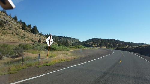
North of Alturas, US-395 winds its way up through mountains with the north fork of the Pit River and the railroad.
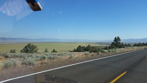
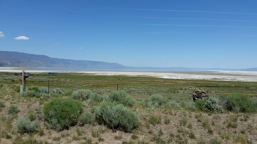
On the other side of the mountains is the valley, with large ranches and the lake from which Lakeview gets its name. In one of these fields I saw another deer, but again I wasn't fast enough with the camera to catch a shot of it.
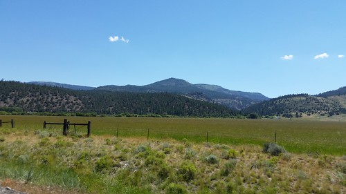
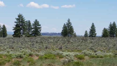
North of Lakeview there were more valley views, with the tree-covered mountains to either side.

This is the far northwestern extremity of the Great Basin, with the characteristic valleys with concessional hills to crest.
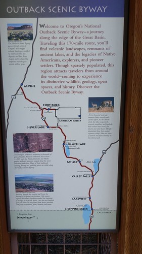
This was our route for much of today: the Oregon Outback Scenic Byway
Part of the trip skirted Silver Lake, which doesn't have a whole lot of lake in it.
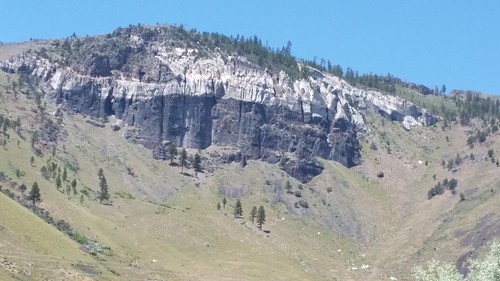
North of Silver Lake was this striking outcrop. There was a whole lot of interesting geology going on around these parts, and my photos only scratch the surface.
Fort Rock, visible in the distance here, is a volcanic structure. It looked interesting, but we decided to not take the time to divert off of OR-31 to go have a closer look.

Speaking of interesting geology, here's a shot of Mount Jefferson taken from the van shortly after we had dinner in Redmond and before our unplanned stop at Crooked River.
We stopped in Bend to check out the military surplus store there from which Lisa has obtained numerous useful things in the past. (Unfortunately, it appears that most of what they now sell is Made in China.) We continued on to Redmond and had at late lunch/early dinner at the Black Bear Diner, picking up another stamp in my Black Bear "passport." (You get one stamp for each new Black Bear you visit. After the 4th and 6th visits you get a prize, and then every 10th visit thereafter. Redmond was my 16th BBD as I work my way toward completing Level 3 in their program.)
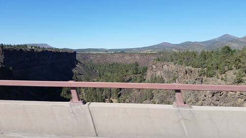
North of Redmond, US-97 crosses the Crooked River on a bridge that usually surprises you, as you are on what appears to be a relatively featureless plain and you suddenly find yourself crossing a deep gorge.
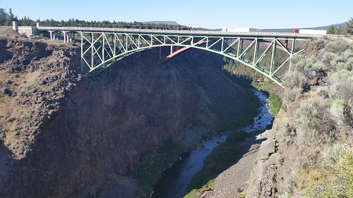
This time I was ready for that gorge and snapped this photo as we crossed over it. Lisa decided (and I agreed) that we should double back to the scenic overlook at the south end of the bridge. This overlook is the Peter S. Ogden Scenic Overlook, which gives excellent access to the three bridges (two road and one rail) located here. Signs at the parking lot warn of the 300-foot cliff ahead.

The original Crooked River (High) Road Bridge is now closed to vehicles, but pedestrians can go onto it. This gives an excellent view (seen here) of the newer Rex T. Barber Veterans Memorial Bridge.

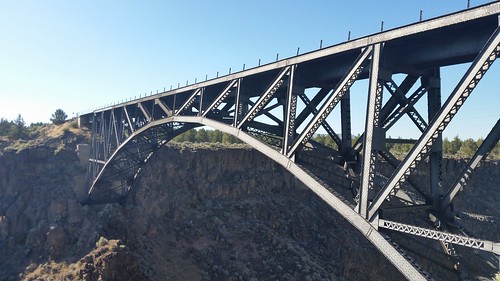
This is the older road bridge, as seen from the walkway along the south edge of the canyon in the Ogden Overlook.
Here you can see both road bridges (the older one is in the foreground) with the Crooked River 300 feet below.
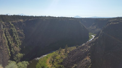
It's a long way down over the parapet. Signs at the parking lot prohibit pets in the park, warning that many dogs have leaped to their deaths over this rim. I was nervous taking these photos, lest I drop my camera phone. I would have been more comfortable with my actual camera, on a cord around my neck. I also entrusted my hat to Lisa while I took these photos, as it was fairly windy and an errant gust could have sent my hat flying irretrievably to the river below.
At the other end of the park is the Oregon Trunk Railway Bridge, which carries the tracks of today's BNSF Railway (ex-Oregon Trunk, SP&S, Northern Pacific, and Burlington Northern) over the canyon.
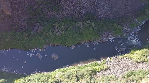
Downstream from the bridges, the Crooked River works on living up to its name.
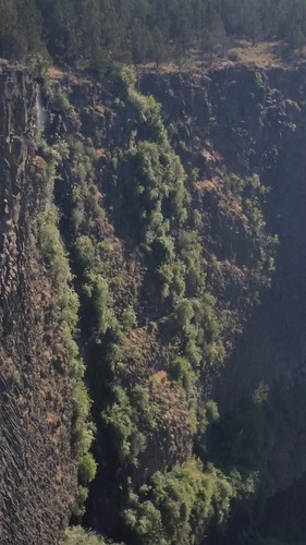
The camera doesn't do justice to this waterfall and to the remarkable rock formations on the canyon walls.
Because we left Alturas three hours earlier than our originally generous schedule called for, we had lots of time to stop and look at things. Consequently, we arrived at our hotel in Madras (the EconoLodge; we could probably have done better, but it's relatively cheap) at almost the exact time of our original schedule.
Tomorrow looks to be a pretty easy drive to Portland.
As we were leaving Alturas, I saw a deer by the side of the paralleling railroad; however, I did not get a picture of it. It wasn't the last deer I'd see today, either.
We stopped at Jerry's Restaurant in Lakeview for breakfast. This mural depicting the Nevada-California-Oregon Railway graces the back of the restaurant.
After breakfast, we walked around downtown Lakeview, which has many handsome brick buildings, a legacy of a fire that leveled the city in its early days.
On our way out of town, we went down to the railroad tracks, where another one of the Baldwin locomotives like the one we saw yesterday languishes in the mysterious ALTX reporting marks.
Even more anonymous is this former Southern Pacific caboose, also sporting obliterated Great Western Railway marks (GWR was a former operator of the ex-SP, ex-NCO Modoc line to Lakeview) and a dilapidated ballast car.
This building is the former Lakeview depot of the NCO, and appears to now be a private residence. (Compare with this photo from 1915.)
Heading north, we diverted one more time to look at the lumber mill that is at about the very northernmost extremity of the line, and provides business to the railroad, including these wood chip cars.
I took a fair number of snaps of the view from the minivan, as the scenery changed from twisting canyons to mountain meadows.
North of Alturas, US-395 winds its way up through mountains with the north fork of the Pit River and the railroad.
On the other side of the mountains is the valley, with large ranches and the lake from which Lakeview gets its name. In one of these fields I saw another deer, but again I wasn't fast enough with the camera to catch a shot of it.
North of Lakeview there were more valley views, with the tree-covered mountains to either side.
This is the far northwestern extremity of the Great Basin, with the characteristic valleys with concessional hills to crest.
This was our route for much of today: the Oregon Outback Scenic Byway
Part of the trip skirted Silver Lake, which doesn't have a whole lot of lake in it.
North of Silver Lake was this striking outcrop. There was a whole lot of interesting geology going on around these parts, and my photos only scratch the surface.
Fort Rock, visible in the distance here, is a volcanic structure. It looked interesting, but we decided to not take the time to divert off of OR-31 to go have a closer look.
Speaking of interesting geology, here's a shot of Mount Jefferson taken from the van shortly after we had dinner in Redmond and before our unplanned stop at Crooked River.
We stopped in Bend to check out the military surplus store there from which Lisa has obtained numerous useful things in the past. (Unfortunately, it appears that most of what they now sell is Made in China.) We continued on to Redmond and had at late lunch/early dinner at the Black Bear Diner, picking up another stamp in my Black Bear "passport." (You get one stamp for each new Black Bear you visit. After the 4th and 6th visits you get a prize, and then every 10th visit thereafter. Redmond was my 16th BBD as I work my way toward completing Level 3 in their program.)
North of Redmond, US-97 crosses the Crooked River on a bridge that usually surprises you, as you are on what appears to be a relatively featureless plain and you suddenly find yourself crossing a deep gorge.
This time I was ready for that gorge and snapped this photo as we crossed over it. Lisa decided (and I agreed) that we should double back to the scenic overlook at the south end of the bridge. This overlook is the Peter S. Ogden Scenic Overlook, which gives excellent access to the three bridges (two road and one rail) located here. Signs at the parking lot warn of the 300-foot cliff ahead.
The original Crooked River (High) Road Bridge is now closed to vehicles, but pedestrians can go onto it. This gives an excellent view (seen here) of the newer Rex T. Barber Veterans Memorial Bridge.
This is the older road bridge, as seen from the walkway along the south edge of the canyon in the Ogden Overlook.
Here you can see both road bridges (the older one is in the foreground) with the Crooked River 300 feet below.
It's a long way down over the parapet. Signs at the parking lot prohibit pets in the park, warning that many dogs have leaped to their deaths over this rim. I was nervous taking these photos, lest I drop my camera phone. I would have been more comfortable with my actual camera, on a cord around my neck. I also entrusted my hat to Lisa while I took these photos, as it was fairly windy and an errant gust could have sent my hat flying irretrievably to the river below.
At the other end of the park is the Oregon Trunk Railway Bridge, which carries the tracks of today's BNSF Railway (ex-Oregon Trunk, SP&S, Northern Pacific, and Burlington Northern) over the canyon.
Downstream from the bridges, the Crooked River works on living up to its name.
The camera doesn't do justice to this waterfall and to the remarkable rock formations on the canyon walls.
Because we left Alturas three hours earlier than our originally generous schedule called for, we had lots of time to stop and look at things. Consequently, we arrived at our hotel in Madras (the EconoLodge; we could probably have done better, but it's relatively cheap) at almost the exact time of our original schedule.
Tomorrow looks to be a pretty easy drive to Portland.